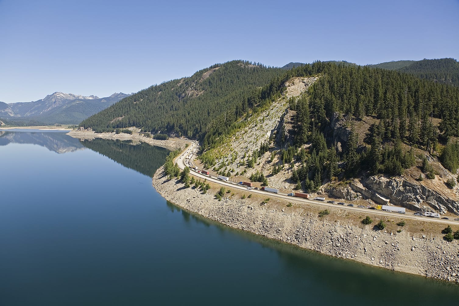
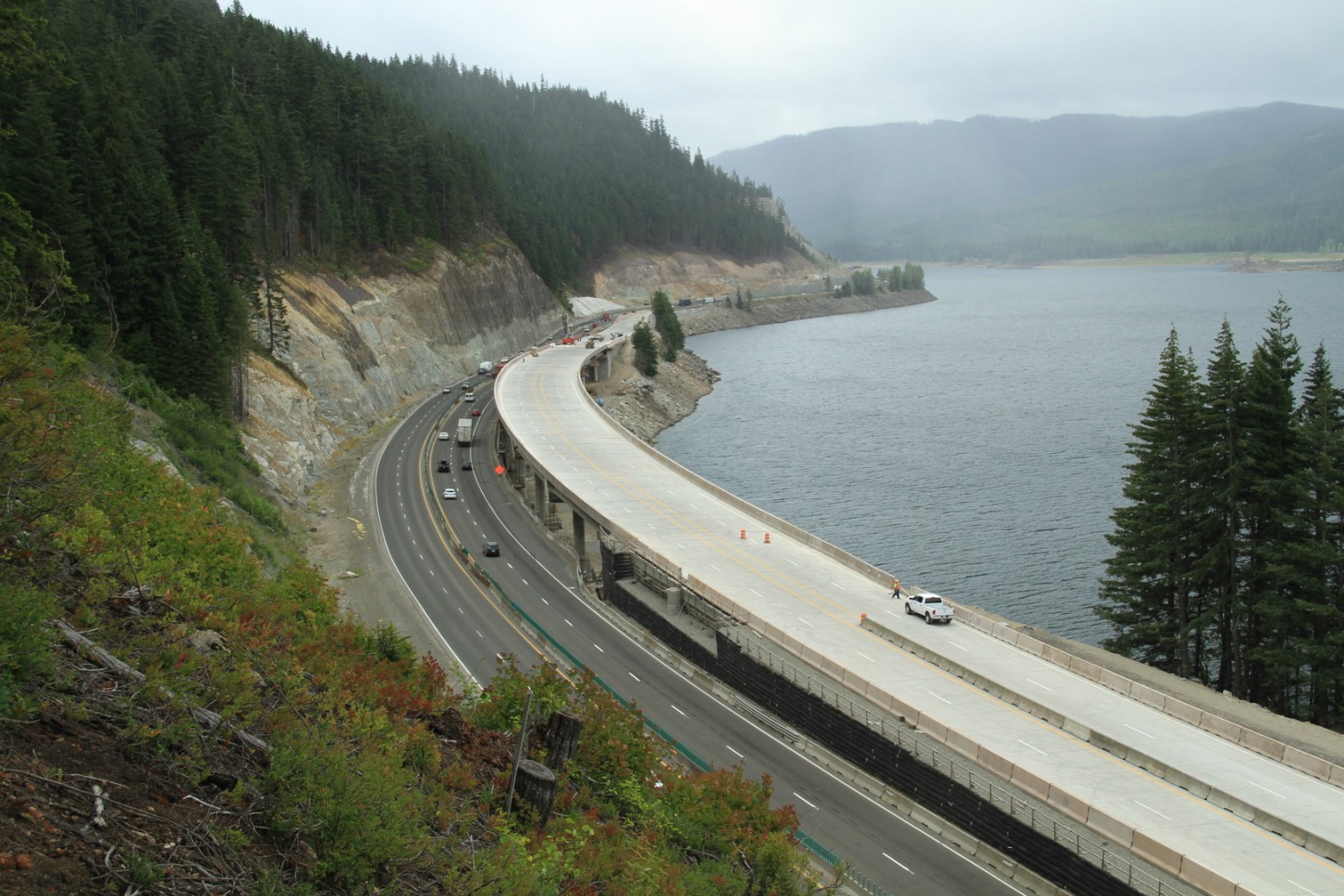
View along Lake Keechelus from I-90 | Source: WSDOT / Mountains to Sound Greenway Trust ✅ State government agency
Lake Keechelus (pronounced /ˈkɛtʃələs/) lies in Kittitas County, Washington State, at an elevation of 2,517 feet (767 m). The lake stretches approximately 4.2 miles (6.8 km) at its longest and 1 mile (1.6 km) at its widest. It is the westernmost of three large alpine lakes along I-90 in the Cascade Range; the other two, Kachess Lake and Cle Elum Lake, lie successively to the east.
After crossing Snoqualmie Pass (elevation 3,020 ft / 920 m), I-90 runs along the lake's eastern shoreline, pressed tight against the mountains. The lake is the headwater source of the Yakima River, which flows east to join the Columbia River.
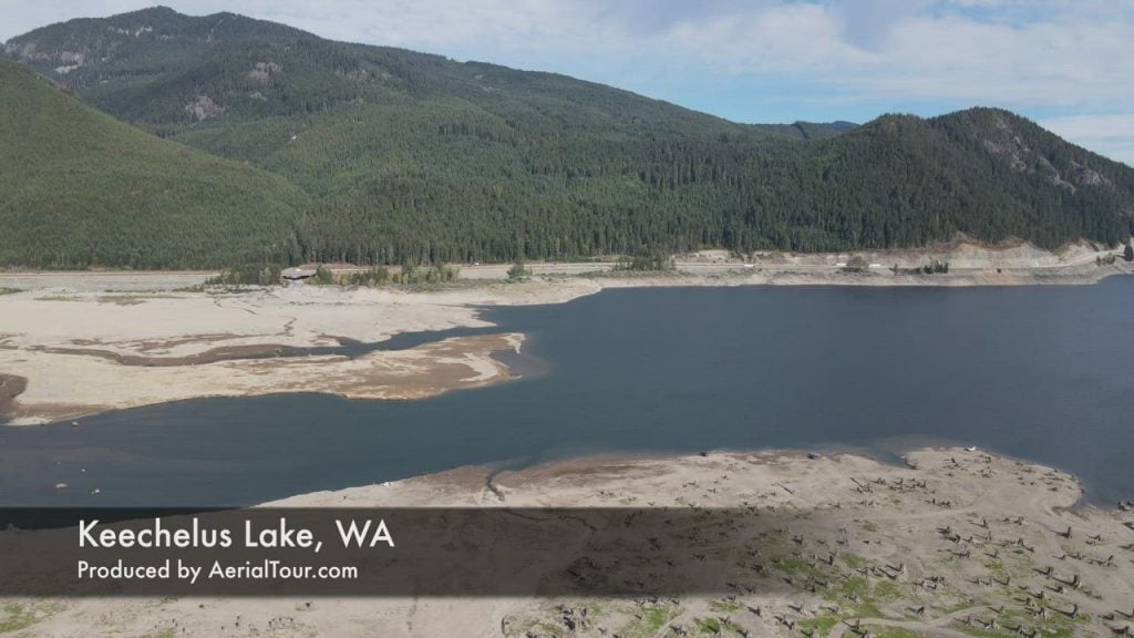
Source: Wikipedia, "Keechelus Lake," https://en.wikipedia.org/wiki/Keechelus_Lake ✅ Medium-high reliability
"Keechelus" derives from a Native American word meaning "few fish." The name stands in direct contrast to neighboring Kachess Lake, whose name means "more fish." Side by side on the map, the two names read like a brief fishery record — a direct reflection of Indigenous observation of these waters.
The traditional inhabitants of this land were the Kittitas people, known in the Sahaptin language as Pshwánapam, meaning "rock people." They are closely related to the Yakama and are sometimes described as a band or subtribe of the Yakama Nation. Their traditional territory covered the Kittitas Valley, the Naches Valley, and the upper Yakima River drainage — Lake Keechelus falls within this territory.
The Kittitas used Snoqualmie Pass and Stampede Pass as trade corridors, serving as intermediaries between Plateau peoples on the east side of the Cascades and Coast Salish groups to the west. In 1814, fur trader Alexander Ross entered the Kittitas Valley and encountered a massive tribal gathering. In his memoir he wrote that the camp stretched more than six miles in every direction, with no fewer than 3,000 men — and three times as many horses. By the early 1860s, white settlers had entered the Kittitas Valley in large numbers, and the Kittitas people were subsequently removed to the Yakama Indian Reservation.
Source note: The name's meaning comes from Wikipedia "Keechelus Lake," where the original text reads "a Native American term" without specifying a language family — the article follows that wording. Indigenous background and the Alexander Ross quotation come from Wikipedia "Kittitas people" (https://en.wikipedia.org/wiki/Kittitas_people), which cites Ross (1855), The Fur Hunters of the Far West.
The basin of Lake Keechelus was shaped by Quaternary glaciation. Geological surveys near the dam reveal two layers of glacial deposits on the valley floor: an older Quaternary Glacial Drift (terminal moraine) and overlying Quaternary Outwash Sediments. The bedrock is rhyolite of the Naches Formation, exposed on the left side of the spillway. Before any human intervention, this was already a natural alpine lake.
Source: U.S. Bureau of Reclamation, "Keechelus Dam," https://www.usbr.gov/projects/index.php?id=294 ✅ Very high reliability
The Yakima Valley receives less than 7 inches (178 mm) of rain per year — fertile soil, but extreme aridity. As early as 1864, settlers dug the valley's first irrigation ditch. Yet after the spring snowmelt flood passed, rivers quickly ran dry, leaving farmers without a reliable water supply.
In June 1902, Congress passed the Newlands Reclamation Act (also known as the National Reclamation Act of 1902), signed by President Theodore Roosevelt, authorizing the federal government to build irrigation works across the arid West. In January 1903, citizens of Yakima County petitioned the Secretary of the Interior for federal involvement. That same year, the U.S. Bureau of Reclamation launched investigations, and in December 1905 formally authorized the Yakima Project.
Source: U.S. Bureau of Reclamation, "The Bureau of Reclamation Recognizes 100 Years of Service to the Yakima Valley" (2005 press release), https://www.usbr.gov/newsroomold/newsrelease/detail.cfm?RecordID=9202 ✅; Newlands Reclamation Act details verified via Wikipedia "Newlands Reclamation Act" (https://en.wikipedia.org/wiki/Newlands_Reclamation_Act) ✅
Keechelus Dam was built at the outlet of the natural lake and completed in 1917. The earthfill structure stands 128 feet (39 m) high and contains 684,000 cubic yards of material. The dam raised the lake's active storage capacity to 157,900 acre-feet (approximately 194.8 million cubic meters), making it one of six reservoirs in the Yakima Project, dedicated to capturing spring snowmelt runoff for season-long agricultural irrigation in the Yakima Valley.
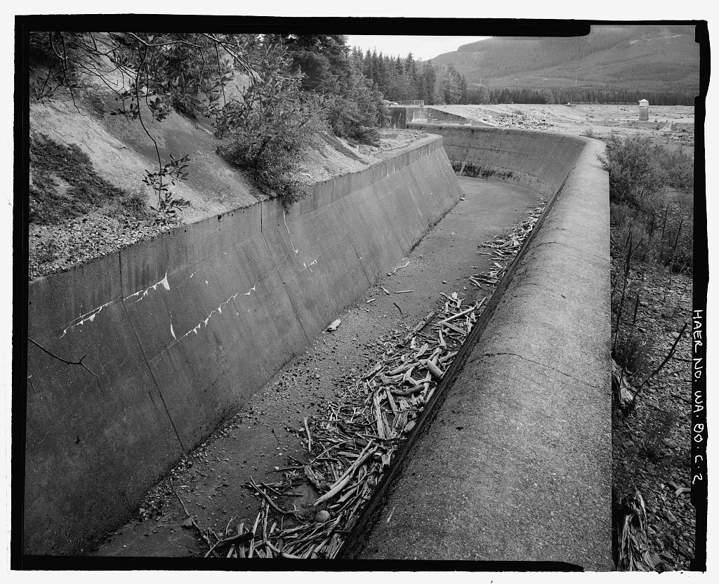
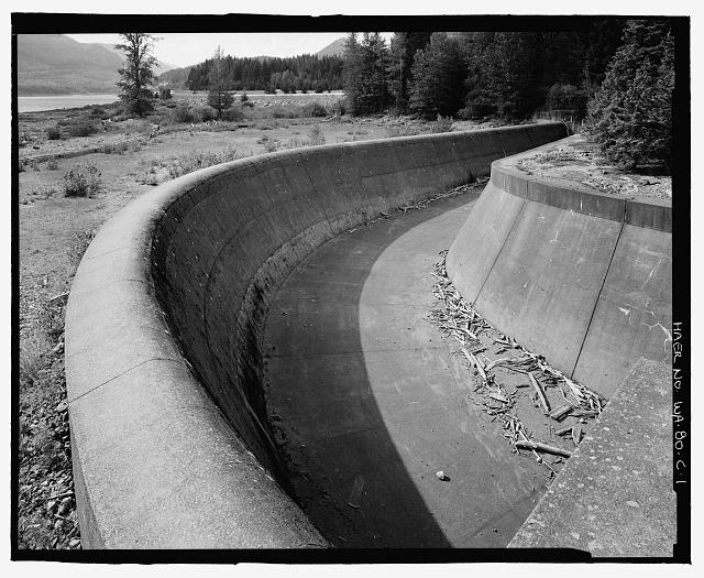
In mid-1998, the Bureau of Reclamation determined that Keechelus Dam had safety deficiencies due to the potential for piping and internal erosion of embankment materials, and imposed a reservoir operating restriction. Between April 2002 and November 2003, the dam underwent major rehabilitation under the Safety of Dams Program: much of the dam cross-section was removed and rebuilt, a bentonite slurry cutoff wall was constructed in the right abutment, and a downstream drain was installed along the entire length of the dam. The operating restriction was lifted in early 2004.
Source: U.S. Bureau of Reclamation, "Keechelus Dam," https://www.usbr.gov/projects/index.php?id=294 ✅ Very high reliability
Alongside the reservoir's history, another story unfolded along the lakeshore. The Chicago, Milwaukee, St. Paul and Pacific Railroad — known as the "Milwaukee Road" — once ran along the lake's western shore, crossing the Cascades through the Snoqualmie Tunnel (2¼ miles (3.625 km) long), with its east portal at Hyak, near the lake's northwest shore.
The Milwaukee Road opened its Pacific Extension to Tacoma in 1909, initially routing trains over Snoqualmie Pass. When the tunnel opened in 1914, trains switched to the tunnel route. In 1937, the railroad built the Milwaukee Ski Bowl near the tunnel's east portal; it operated until 1950. After multiple bankruptcies, the Milwaukee Road abandoned its lines in 1980. The right-of-way is now a rail trail — Iron Horse State Park (officially the Palouse to Cascades State Park Trail) — and the tunnel remains open to hikers and cyclists.
Source: Wikipedia, "Keechelus Lake" (https://en.wikipedia.org/wiki/Keechelus_Lake); tunnel construction dates cross-verified via Wikipedia "Snoqualmie Tunnel" (https://en.wikipedia.org/wiki/Snoqualmie_Tunnel) ✅
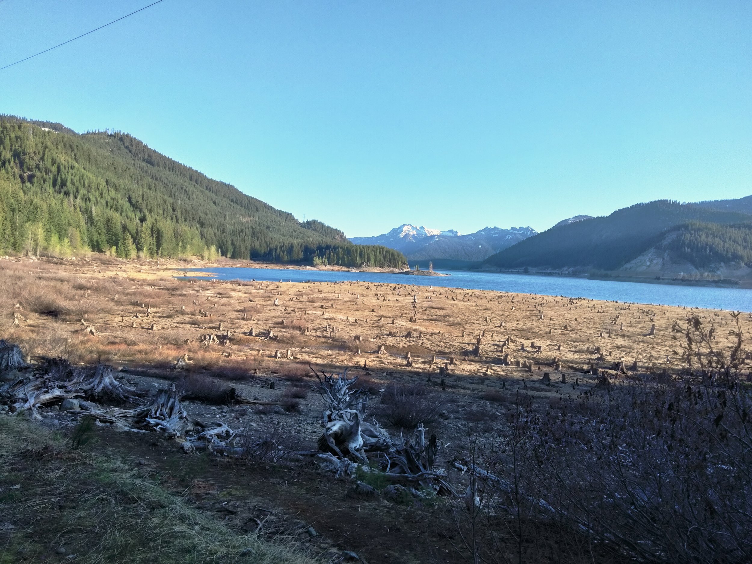
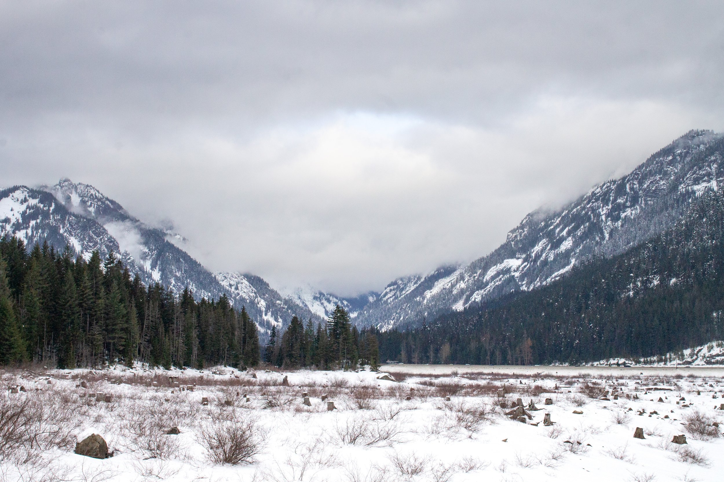
As a reservoir, Lake Keechelus experiences dramatic water-level fluctuations across seasons and years. The lake fills during spring snowmelt and drains through summer and fall for irrigation. In dry years, the water level drops sharply, exposing dead tree stumps and a prominent bathtub ring on the surrounding hillsides — the most visible sign to I-90 drivers that this is a managed reservoir, not a pristine alpine lake.
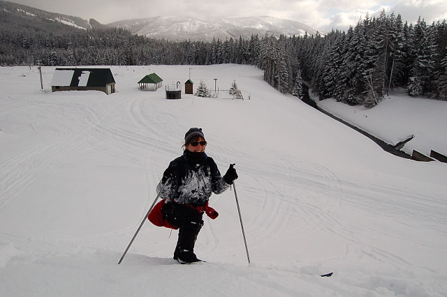
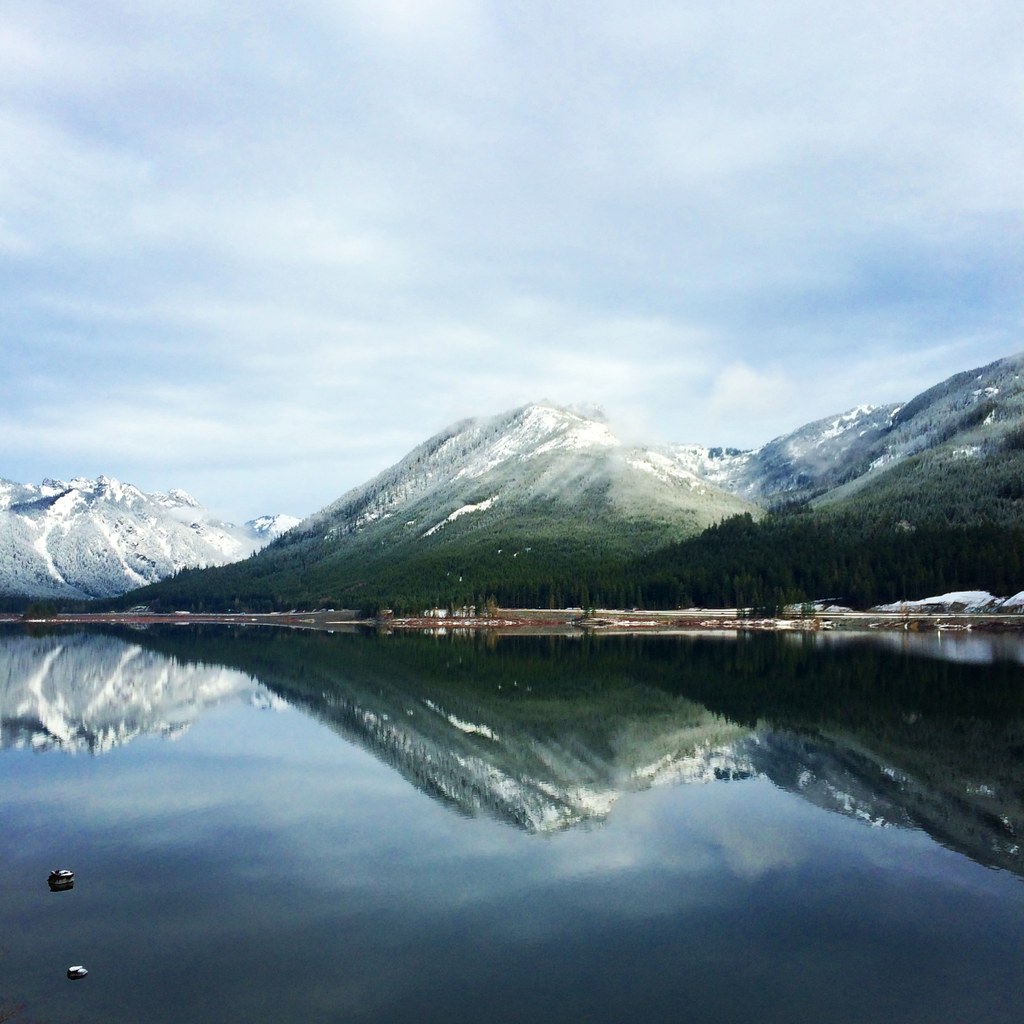
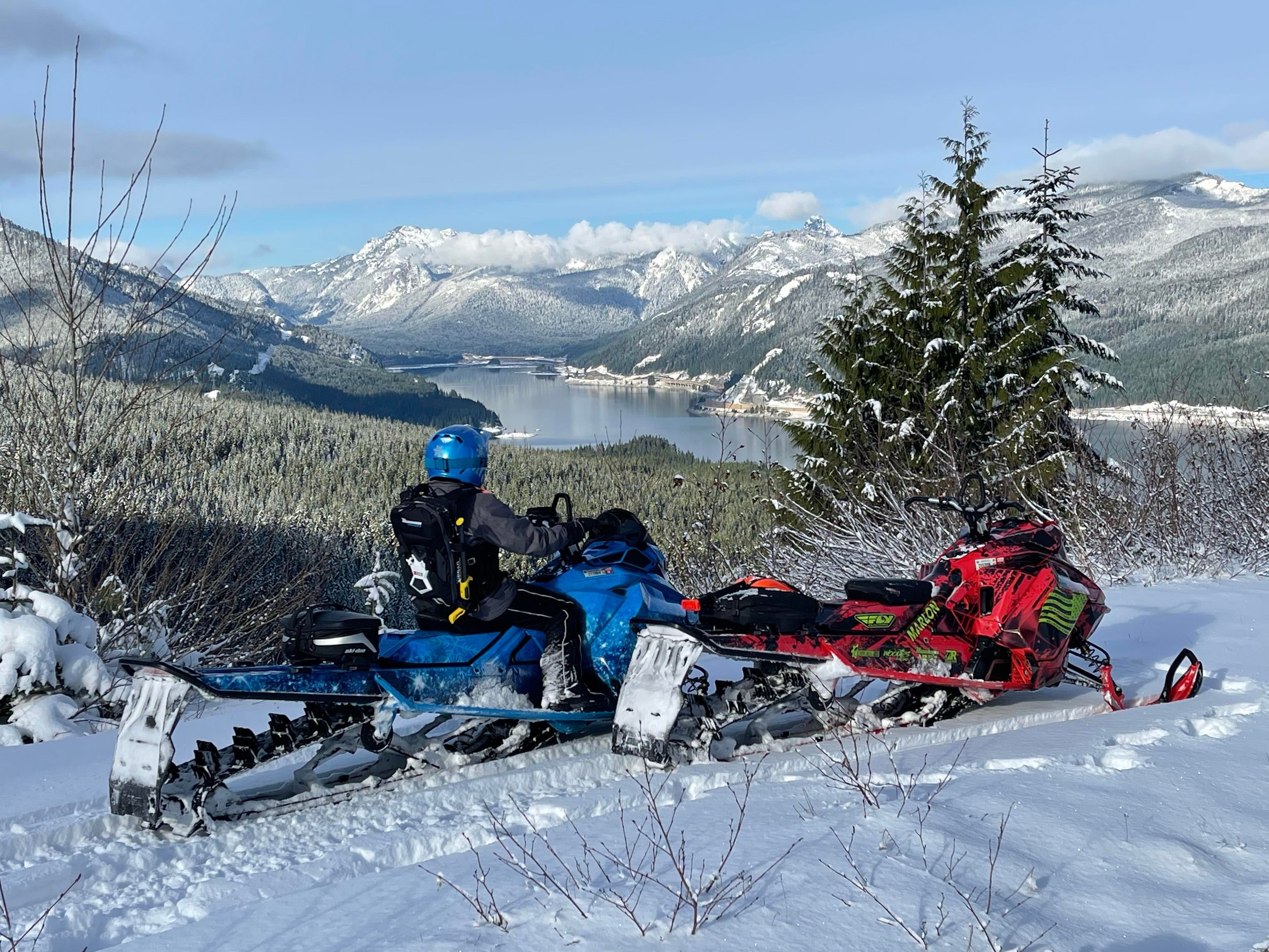
Each winter, deep snow blankets the Lake Keechelus area and the lake surface sometimes freezes, making it a popular destination for snowshoeing and cross-country skiing. The Snoqualmie Pass ski area lies just a few kilometers to the northwest.
As climate change intensifies drought pressure in the Yakima Basin, the Bureau of Reclamation and the Washington State Department of Ecology are jointly advancing the Keechelus-to-Kachess Conveyance (KKC) project. The project would divert water from the Yakima River immediately downstream of Keechelus Dam and convey it through a new tunnel to Kachess Reservoir, serving two purposes: first, to reduce high flows below the dam at certain times of year, providing spawning and rearing habitat for Chinook salmon and steelhead; second, to accelerate refilling of Kachess Reservoir in drought years in conjunction with the proposed Kachess Drought Relief Pumping Plant (KDRPP). On April 26, 2019, the Bureau of Reclamation's Pacific Northwest Regional Director signed the Record of Decision for the project.
Source: U.S. Bureau of Reclamation, "Keechelus-to-Kachess Conveyance Project," https://www.usbr.gov/pn/programs/eis/kkc/index.html ✅ Very high reliability
| Source | Nature | Reliability |
|---|---|---|
| Wikipedia "Keechelus Lake" | Encyclopedia article citing Phillips 1971 (UW Press) and other academic works | ✅ Medium-high |
| Wikipedia "Kittitas people" | Encyclopedia article citing Ross (1855) primary source and linguistic scholarship | ✅ Medium |
| Wikipedia "Snoqualmie Tunnel" | Encyclopedia article citing multiple historical sources | ✅ Medium-high |
| Wikipedia "Newlands Reclamation Act" | Encyclopedia article citing congressional legislation text | ✅ Medium-high |
| U.S. Bureau of Reclamation "Keechelus Dam" | Federal government official page — dam builder and operator | ✅ Very high |
| U.S. Bureau of Reclamation 100th anniversary press release (2005) | Federal agency press release | ✅ High |
| U.S. Bureau of Reclamation "KKC Project" | Federal government official project page | ✅ Very high |
| ENR Northwest, I-90 project coverage (2020) | Authoritative engineering trade publication | ✅ High |
| Image | Source | Reliability |
|---|---|---|
| View along I-90 (cover) | WSDOT via Mountains to Sound Greenway Trust | ✅ High (state government agency) |
| Dam spillway (historic) | Library of Congress / HAER | ✅ Very high (federal archive) |
| Dam spillway panorama (historic) | Library of Congress / HAER | ✅ Very high (federal archive) |
| Iron Horse Trail | Washington Trails Association (WTA) | ✅ Medium-high (nonprofit) |
| I-90 construction | Clark Construction, verified via ENR | ✅ Medium-high |
| Aerial view | Aerial Tours (commercial website) | ⚠️ Content accurate, no attribution |
| Low water shoreline | Northwest Portal (personal blog) | ⚠️ Content accurate, no attribution |
| Winter snow scene | Northwest Portal (personal blog) | ⚠️ Content accurate, no attribution |
| Snowshoeing | Pines and Vines (personal blog) | ⚠️ Content accurate, no attribution |
| Dam top trail | Celebrate Big! (personal blog) | ⚠️ Content accurate, no attribution |