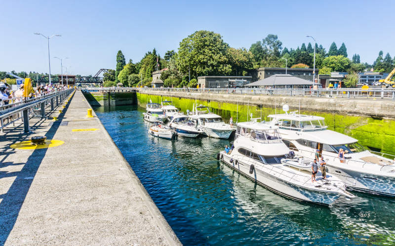
On a summer afternoon, a sailboat glides into a concrete channel at the edge of Seattle's Ballard neighborhood. The gates close behind the hull. The water begins to rise — not because of the tide, but because valves engineered more than a century ago are flooding the chamber. Within minutes, the boat sits six meters above Puget Sound. The far gates swing open, and ahead lies a completely different body of water: darker, calmer, fresh.
This is the Hiram M. Chittenden Locks, known locally as the Ballard Locks. They are the busiest locks on the West Coast of the United States, and the only lock system in the country that simultaneously separates salt water from fresh water while accommodating tidal fluctuations. Tens of thousands of vessels pass through each year — luxury yachts, commercial fishing boats, kayaks, and Coast Guard patrol craft alike. But what makes these locks truly fascinating is the fundamental problem they solve: Why didn't saltwater intrusion threaten Lake Washington before the canal was built? And why, once the canal was dug, did preventing it require such precise engineering?
I. Before the Canal: Two Worlds, Naturally Sealed Apart
To understand the answer, we need to go back to the geography of Seattle before 1916.
Lake Washington is a classic glacial lake sitting east of downtown Seattle. Its surface sits approximately 6–6.7 meters (20–22 feet) above mean sea level. Its water comes from the Sammamish River to the east and snowmelt from the Cascades. Its only outlet was at the lake's southern end — a modest river called the Black River, which flowed southwest, joined the Duwamish River, and eventually emptied into Elliott Bay and Puget Sound.
This is the key geographic fact: Lake Washington drained southward, while Puget Sound lay to the west. Between them stretched the entire urban core of Seattle, a ridge of hills, and no direct water connection whatsoever. For Puget Sound's saltwater to reach Lake Washington, it would have had to flow uphill against the current — physically impossible under natural conditions.
Between Lake Washington and Puget Sound lay another body of water: Salmon Bay, a narrow tidal inlet that opened westward into Shilshole Bay. Before the canal, Salmon Bay was entirely saltwater, rising and falling with the tides. But it had no direct connection to Lake Washington either — the two were separated by land and by Lake Union, a smaller freshwater lake in between.
So the answer to why saltwater didn't intrude before the canal is straightforward: there was no passage. Lake Washington's only outlet ran south, away from Puget Sound. Salmon Bay was a tidal inlet, but it was cut off from the lake by land. The two water bodies existed in complete isolation from each other.
That isolation, however, was also Seattle's greatest economic obstacle.
II. A City's Ambition: Why Dig the Canal at All?
By the late 19th century, Seattle was expanding rapidly. Coal from inland mines, timber from the forests, and agricultural goods all needed to reach the harbor — but the logistics were punishing. According to the American Society of Civil Engineers (ASCE), before the canal was built, a single shipment of coal from the inland mines required eleven separate transfers before reaching Seattle's port. Timber had to be hauled by wagon over muddy mountain roads to reach the coastal mills.
As early as July 4, 1854, Seattle pioneer Thomas Mercer proposed at an Independence Day picnic that a canal should one day link Lake Union and Lake Washington to Puget Sound. It would take exactly 63 years for that vision to become reality.
The central controversy, however, was always the saltwater problem.
Once a canal was dug, Puget Sound's saltwater would be directly connected to the inland freshwater system. Without careful engineering, salt water could migrate up the canal, contaminating Lake Washington and Lake Union, destroying salmon spawning habitat, and threatening the water supply for communities along the shores. This was not a hypothetical concern — it was a concrete engineering challenge that had to be solved before a single shovel of earth was turned.
📐 Key Geographic Data
- Lake Washington surface elevation: ~6–6.7 m (20–22 ft) above mean sea level (USACE official data)
- Puget Sound tidal range: ~3.7 m (12 ft)
- Canal total length: ~13 km (8 miles)
- Salmon Bay water level rise after locks: ~6 m (20 ft)
III. Chittenden's Solution: Concrete, Dual Locks, and Gravity-Powered Salt Removal
In 1891, the U.S. Army Corps of Engineers completed a survey of possible canal routes. In 1906, developer James A. Moore secured Congressional approval for a private canal project, but his plans were widely criticized as too modest and underfunded. That same year, Major Hiram M. Chittenden took over as Seattle District Engineer and fundamentally redesigned the project, pushing for federal government ownership and a far more ambitious scope.
Chittenden's first insistence was: concrete, not wood. Wood would rot. If the lock gates failed, Lake Washington's freshwater would drain directly into Puget Sound — a catastrophic outcome. Concrete was more expensive, but it would last a century or more. He was right: the locks are still in operation today.
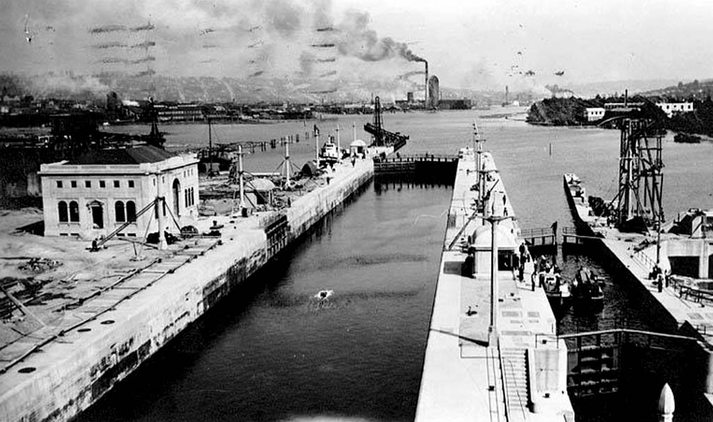
His second insistence was: two locks, not one. The large lock — 251.5 meters (825 feet) long and 24.4 meters (80 feet) wide — could accommodate large commercial and naval vessels. The small lock — 45.7 meters (150 feet) long and 8.5 meters (30 feet) wide — was reserved for recreational boats and smaller craft. This dual design improved throughput efficiency and, crucially, reduced the volume of freshwater lost with each lockage.
But the most ingenious innovation was Chittenden's approach to saltwater intrusion.
Salt water is denser than fresh water. When a vessel enters the lock from Puget Sound, the seawater in the chamber is carried along with it into the freshwater side. Chittenden's design placed a sump — a collection basin — upstream of the locks. Because salt water is heavier, it naturally sinks and flows into the sump, where pipes and gravity carry it back into Puget Sound. No pumps required. It is an elegant application of basic physics, and one of the reasons the ASCE designated the locks a National Historic Civil Engineering Landmark.
"Chittenden is the only lock system in the U.S. that separates salt and fresh water and that can accommodate tidal fluctuations." — American Society of Civil Engineers (ASCE)
IV. Construction: A Battle Against Water
In August 1911, workers began building a cofferdam at the mouth of Salmon Bay — a temporary watertight barrier that allowed construction to proceed in a dry environment. The cofferdam stretched approximately 700 meters (2,300 feet) and took nearly a year to complete.
Workers then excavated roughly 245,000 cubic yards of material to create the lock pit. Concrete pouring began in 1913 and was largely complete by 1914. Nine lock gates were installed shortly before the concrete work finished.
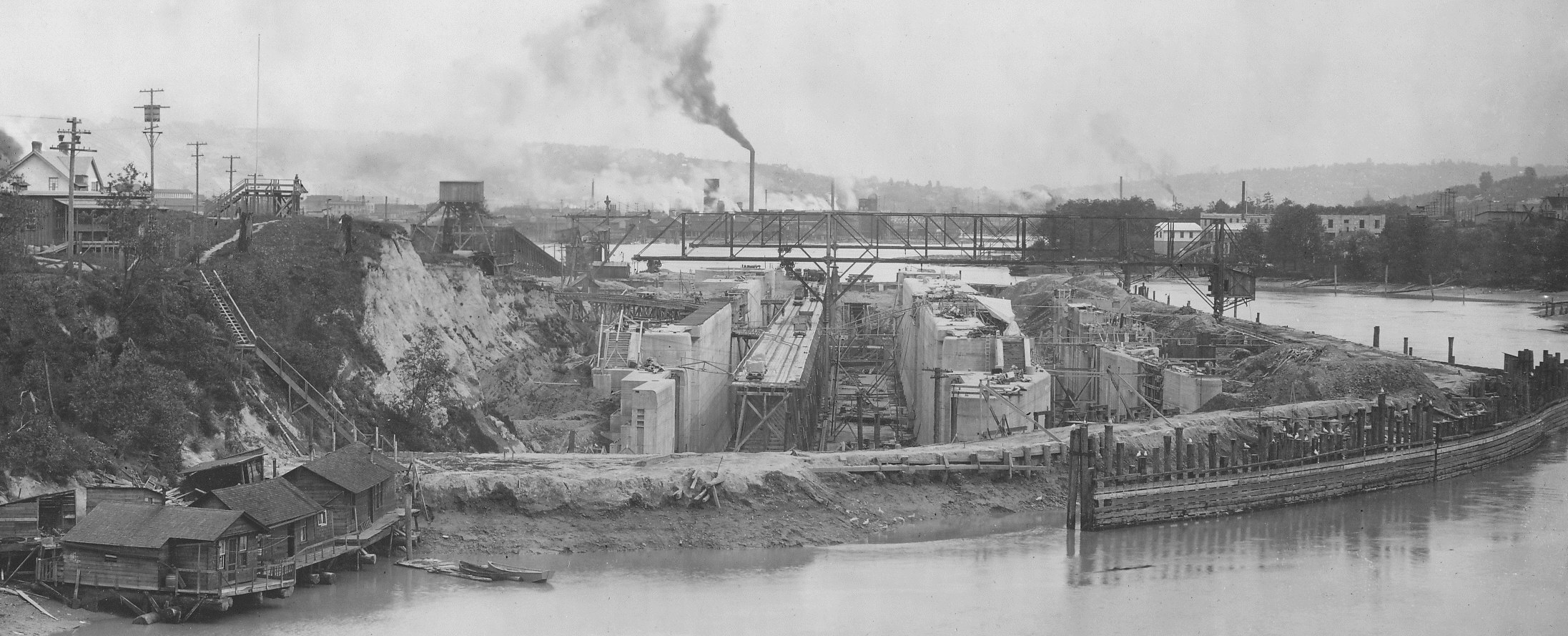
The final challenge was raising Salmon Bay's water level from tidal sea level to match the inland freshwater system. Engineers built a second cofferdam with a spillway on the seaward side, using the spillway to carefully control the rate at which water entered the bay. It took nearly three weeks for Salmon Bay's water level to rise high enough for vessels to pass through.
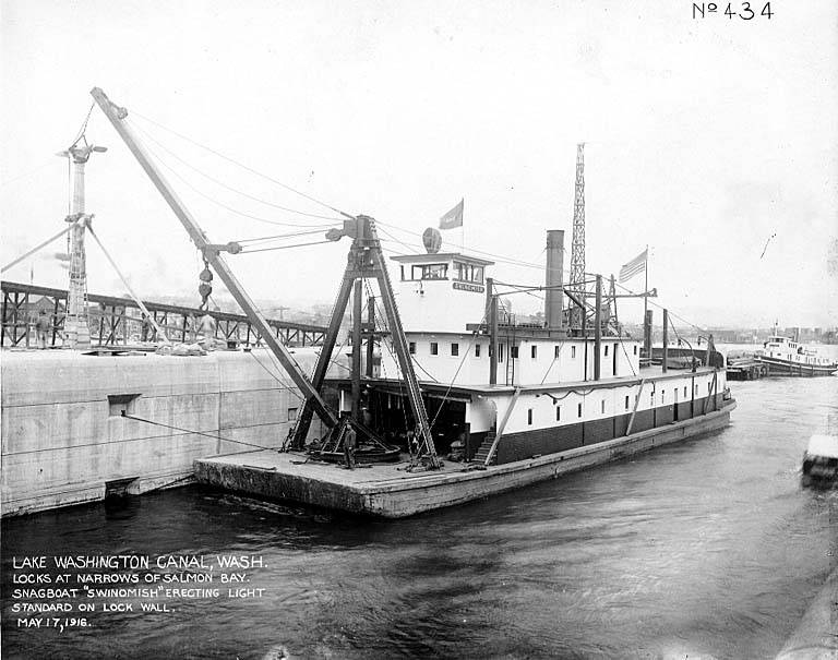
In February 1916, the Army Corps' workboat Orcas made trial lockages through the large lock; in July it completed trials in the small lock. On August 3, 1916, an informal opening celebration was held, with the snag steamer Swinomish becoming the first civilian vessel to pass through. The official dedication of the entire Lake Washington Ship Canal took place on July 4, 1917.
Chittenden himself never witnessed the celebration. He had been forced to retire due to illness in 1909, though he continued to serve as a consulting engineer. He died on October 9, 1917 — just months after the official opening. In his honor, the locks were formally renamed the Hiram M. Chittenden Locks in 1956.
V. An Unintended Consequence: The Black River Vanishes
The canal connected Lake Washington directly to Puget Sound, giving the lake's water a shorter, lower path to the sea. On August 28, 1916, Lake Washington's water level began to drop, ultimately falling approximately 2.7 meters (8.8 feet).
This drop dried up the Black River — Lake Washington's only natural outlet for thousands of years. As the lake level fell below the river's channel entrance at its south end, the flow slowed to a trickle and then stopped entirely. The Duwamish people had lived along the Black River for centuries, fishing its waters and building their communities on its banks. When the river disappeared, so did their way of life. The engineering triumph came at the cost of an indigenous community's homeland.
VI. Saltwater Intrusion: An Ongoing Battle
Chittenden's sump design works well under normal conditions — but it is not infallible.
According to a 1995 peer-reviewed study (Mausshardt & Singleton, 1995), every time a vessel enters the lock from Puget Sound, a pulse of salt water is carried into the freshwater side of the system. During the summer peak season, the sump cannot drain salt water fast enough to keep pace with the inflow, and a measurable amount of salt water migrates into the eastern, freshwater portion of Salmon Bay. To address this, the U.S. Army Corps of Engineers implements a procedure called "miniflushing" during summer months: before and after each lockage, specific valve sequences are used to flush residual salt water back toward Puget Sound using freshwater pressure.
Separating salt water from fresh water is never a static problem — it requires continuous monitoring and active intervention, season after season.
VII. The Fish Ladder: A Path Left Open for Salmon
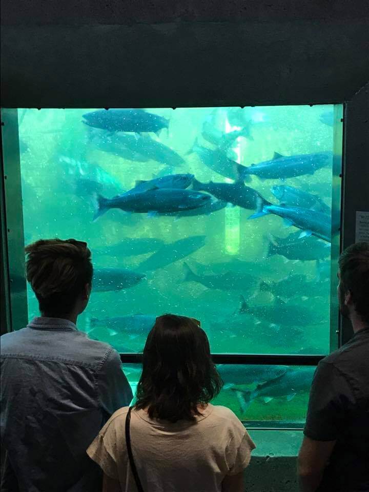
The locks cut off the salmon migration route — fish need to travel from Puget Sound upstream into Lake Washington and its tributary rivers to spawn, but the lock gates presented an impassable barrier. To address this, engineers built a fish ladder alongside the locks — one of the earliest fish ladders constructed in the United States. The ladder consists of a series of stepped pools, each slightly higher than the last. Salmon use the current flowing through the pools to leap their way upward, bypassing the locks entirely and continuing their journey to the spawning grounds.
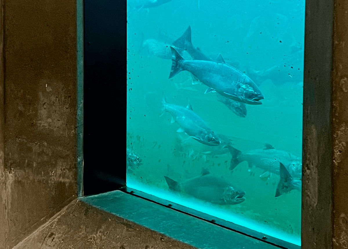
Each year from July through November, thousands of coho salmon, chinook salmon, and steelhead pass through the ladder. Underwater viewing windows alongside the ladder allow visitors to watch the fish swimming past at close range — one of Seattle's most popular free natural experiences, and a quiet symbol of the uneasy truce between industrial infrastructure and the natural world.
VIII. A Century Later: Still Running
In 2017, the Ballard Locks marked their centennial. The locks had been listed on the National Register of Historic Places since 1978. In 2017, the American Society of Civil Engineers (ASCE) designated them a National Historic Civil Engineering Landmark, recognizing their lasting contribution to engineering practice.
Today, the locks receive more than one million visitors per year, making them one of Seattle's most-visited free attractions. Adjacent to the locks is the Carl S. English Jr. Botanical Garden, built on land reclaimed from the dredging spoils of the original canal excavation, and home to more than 500 plant species from around the world.
The locks themselves remain under the operation and maintenance of the U.S. Army Corps of Engineers. More than 40,000 vessel transits pass through each year, making them the busiest locks in the United States.
Standing at the lock wall and watching a sailboat rise six meters in a matter of minutes, it is hard not to feel a certain respect for what was built here. It is not the grandest water engineering project in the world. But the problem it solved was precise: carving a passage where none should exist; drawing an exact boundary between salt and fresh; finding — imperfectly, but persistently — a way for a city and its waterways to coexist.
Every time those gates swing open, the century-old engineering plays out again.